|
Days 19 - 24
Length of section: 78.9 Km in 6
days
Accommodation is fairly easy to book for these six
days but there is an advantage in using a single base: if you get a
terrible day's weather you can then have an off day. And it is likely
that you will! Try the accommodation page
for further advice. Beddgelert would be ideal as a
base.
You should note that parking is difficult in the
busiest parts of Snowdonia. All the routes on this page start and
finish close to parking areas but Pen y Gwryd and Ogwen Cottage rapidly
become full at peak times.
The route details for any of the 24 days may be quickly found by
going to the route map page and
clicking the right spot on one of the maps. Then use the browser's back
arrow (top left if you are using Explorer) to return to the map
page to locate further days' route details.
Rights of Way
Virtually all the route described below lies on legal or
permissive rights of way (the few bits that don't, cross open
moorland where there is Right to Roam). This means that no one
can legally stop you from following the route although you could meet
temporary diversions.
As you may already know from bitter experience,
not all rights of way shown on the map can be easily followed. Some parts
of the pre-2010 route have become densely vegetated, bridges are
broken down and farmers have placed illegal barbed wire to prevent cattle
from straying.
After re-walking the whole route in 2010, I have
therefore extensively revised the route details in the light of
changing circumstances. The entire route described below can be
followed at present (January 2011) and where there
are special difficulties they are mentioned in the accompanying
notes.
There will be places where an inviting looking right of way
shown on the map appears to offer a better way than the one suggested.
Tigers will probably succeed but try them at your own risk.
If you are
successful, or if you have any other comments to make, please email me,
Michael Slaney, by clicking here
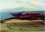
Day 19 - Llyn Cwm Bychan
to Trawsfynydd village
distance from St David's:
332.9 Km
| start at Llyn Cwm Bychan |
SH
645
315 |
| path |
1.6 |
Roman Steps |
653
303 |
| path |
1.7 |
Gate into wood |
666
297 |
| path |
0.6 |
Waterfall |
672
297 |
| retrace steps |
0.2 |
meet forest road |
670
298 |
| follow road N |
1.7 |
path on left |
676
312 |
| path |
0.1 |
Hafod-Gynfal |
676
313 |
| path |
0.2 |
Stile |
656
315 |
| only traces of path |
2.3 |
Wern fach |
682 333 |
| track |
0.7 |
road |
687 335 |
| road |
2.6 |
Trawsfynydd foot bridge |
702 348 |
| foot bridge, path |
1.0 |
Trawsfynydd village |
708 357 | |
This day differs from the pre-2010 website and has
been changed to include the famous so-called "Roman Steps".
Take care when entering the forest. The gate at
888297 is well south of the green line on the map but is
reached by follow-ing the actial path on the ground. The route then visits a waterfall, explores
Coed y Brenin and passes a fascinating ruined farm at
Hafod-Gynfal. There used to be a serious problem
here but it has been corrected by the efforts of Gwynedd CC and the
Forestry Commission.
The scenery
here is top class.
On reaching the village of
Trawsfynydd do not miss the memorial to Hedd Wyn and ask
someone to explain the story to
you. |
total for day 12.7 Km
distance from St David's 345.6 Km
Day 20 - Trawsfynydd
village to Oakeley Arms
distance from St David's 345.6
Km
| start at Trawsfynydd village |
SH
708
357 |
| road |
0.8 |
A470 turn left |
708
361 |
| A470 North** |
0.8 |
track on right |
709
373 |
| path/track |
3.9 |
near Roman fort |
708
389 |
| bridleway |
1.8 |
crossing A470 |
705
404 |
| bridleway |
1.1 |
Cynfal waterfall |
706
412 |
| path S of river |
1.0 |
footbridge |
697
415 |
| cross bridge |
0.2 |
left fork |
698
416 |
| path |
0.7 |
left at intersection |
691
417 |
| path |
1.2 |
B4391. then quickly left, right, left |
607
416 |
| pleasant lane |
2.8 |
A487 |
663
410 |
| A487 west |
0.2 |
Oakeley Arms |
681
410 | |
** Here, if you are
tired or if the weather is bad, you can shorten the day
substantially by using a Gwynedd CC Lon Las. If you walk on the
left side of the A470 you will find yourself on a fine cycle track
which turns left off the road at 709372 This goes easily to
Maentwrog, only a few yards from the Oakeley Arms.
But the
way shown is better. The country near the Roman Fort on the
famous Roman road Sarn Helen, is invigorating but the best
point on the walk is the little-known Cynfal waterfall,
remote and beautiful - once quite a famous tourist
spot.
. |
total for day 14.5 Km
distance from St David's 360.1 Km
Day 21 - Oakeley Arms to
Beddgelert
distance from St David's 360.1 Km
| Start at Oakley Arms |
SH
681 410 |
| road (B4410) |
1.0 |
Llyn Mair. far end |
665 412 |
| path uphill,left |
1.1 |
Railway station |
651
414 |
| cross bridge, follow path |
0.1 |
minor road |
649
416 |
| minor road |
4.2 |
Croesor (Coffee!) |
631 447 |
| path on old road |
2.6 |
Bwlchgwernog |
611 452 |
| minor road |
2.0 |
through Nantmor to A4085 |
598 461 |
| A4085 west |
0.1 |
Aberglaslyn carpark on right |
597 461 |
| path from top left of park |
2.4 |
railway bridge on left - do not cross it |
592 474 |
| path, E side of river |
0.7 |
footbridge on left - cross it |
592 481 |
| quiet road |
0.2 |
Beddgelert bridge |
590
481 | |
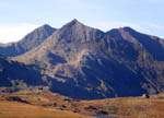
You are now approaching the major mountains of
Wales and today offers splendid views with little effort.The Welsh
Highland Railway has now prevented walkers from passing through
the old tunnel at Pont Aberglaslyn but a fine path
exists between the tunnel and the river - quite exciting if there
has been a lot of rain.
There is a delightful, new coffee shop
and gallery at Croesor and a brilliant spot for lunch by a
stream at 624452, half an hour after
Croesor |
total for day 14.4 Km
distance from St David's 374.5
Km
Day 22 - Beddgelert to
Pen-y-Gwryd
distance from St David's 374.5 Km
| start at Beddgelert bridge |
SH
590
481 |
| quiet road |
0.2 |
footbridge -cross it and turn left |
592 481 |
| road/path |
0.4 |
minor road - turn right |
594 484 |
| minor road |
1.4 |
turn left approaching Sygun mine |
604 489 |
| path |
3.0 |
past Llyndy Isaf |
627 502 |
| minor road, then A498 right |
0.7 |
'white road' left |
627 506 |
| 'white road'** |
1.0 |
Hafod-y-llan |
629 513 |
| track |
0.7 |
path nr Llyn Gwynant |
635 515 |
| path |
1.0 |
right fork |
641
520 |
| path |
3.0 |
electricity works |
654 541 |
| track |
2.1 |
layby nr Pen-y-Gwryd |
660 557 | |
** The route given here offers agreeable, easy
walking, ideal when the cloud base is low. If conditions are better,
however, and you don't need an easy day, you will probably want to
walk over Snowdon, or at least over Lliwedd. There are three
well-known routes, all of which start by forking left onto the
Watkin Path at 627510 off this white road. You will then finish at
Pen y Pass. At Pen-y-Pass, do not walk down to the Pen-y-Gwrhyd.
Finish the day at Pen-y-Pass (see the accommodation page) and on day
23 walk the modified start (see the next days detailed
notes)
A very easy and attractive day. At about 641520 be
sure to keep right or you will miss the splendid rocky point
overlooking Llyn Gwynant where you can have
lunch. |
total for day 13,5 Km
distance from St David's 388.0
Km
Day 23 - Pen-y-Gwryd to Ogwen
Cottage
distance from St David's 388,0 Km
| start at lay-by near Pen-y-Gwryd hotel |
SH
660 557 |
| road (A498/A4086) |
0.4 |
start of miners' track |
661 559 |
| path |
2.3 |
fork. keep right ** |
668
580 |
| path |
0.4 |
end of Glyder ridge - descend right |
667 583 |
| path |
1.0 |
Bwlch Tryfan |
662 588 |
| path |
1.1 |
cross stream from L Bochlwyd, E to W |
656
594 |
| path, steeply down (stream on your R) |
1.2 |
Ogwen Cottage car park |
649 604 | |
If you finished day 22 at Pen-y-Pass, you will
not need to go down to Pen-y-Gwryd to start your day but will climb
gently from the Hostel , leaving Llyn Cwmffynnon on your left and
contouring round to join this route at about 662567.
As on
day 22, the route given here is ideal for low cloud. If the cloud is
higher you will enjoy the wonderful view back to Crib Goch, one
of the finest in Wales.
**If you
wish you can continue easily to the top of Glyder Fach 656 683
and cross the roughest mountain terrainy in Wales to Glyder Fawr 643
579, descending to the right of Llyn y Cwn and, leaving the high
plateau at 639 587, walking past Llyn Idwal (either side) to Ogwen
Cottage
|
total for day 6.4 Km
distance from St David's 394.4 Km
Day 24 - Ogwen Cottage to Bangor
Cathedral
distance from St David's 394.4 Km
| start at Ogwen Cottage car park |
SH
649 604 |
| minor road |
4.3 |
cycle track start left |
630
637 |
| cycle track/quarry track |
2.1 |
Ogwen Bank |
626
654 |
| cycle track/quarry track |
1.8 |
open area - bear right |
615
663 |
| short link to road |
0.2 |
meet B4409, turn left |
623 656 |
| road (B4409) |
2.1 |
Tregarth pub |
605 679 |
| road (B4409) |
0.5 |
start of cycle track |
601 680 |
| cycle track |
4.1 |
road nr Tyddyn-mynyddig |
587 707 |
| minor roads |
1.5 |
path nr water co. site |
581 716 |
| path |
0.5 |
Bangor |
581 718 |
| small town roads |
0.3 |
Bangor cathedral |
581 721 | |
This is a much more interesting day than it
appears on the map. Until 2.3 k from Bangor, it follows
the County Council's Lon Las Ogwen, a general purpose
track for cycling or walking. There is some fascinating quarry
scenery and at Ogwen Bank it is possible to scramble up a slate bank
and see a huge. man-made hole with a lake in it. Here the OS map has
no contours because the map makers presumably believed they would
not be "fixed in stone" (the only joke on his website site
and not a very good one)
There is a fine field for lunch at
613672, 0.8k after joining the B4409, a very quiet road.
The
route finishes neatly arriving in Bangor without using any roads
until you are only 100 metres from the
Cathedral.
|
total for day 24.4 Km
distance from St David's 418.8
Km |